記事番号: 1-5482
公開日 2018年03月16日
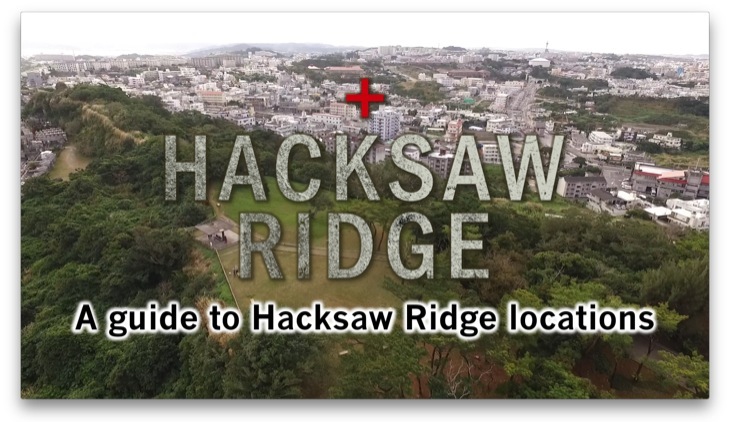
To those who are not familiar with Hacksaw Ridge site
Hacksaw Ridge is a movie directed by Mel Gibson, based on a real story of Desmond Doss who served in the battle of Okinawa during World War II.
As over 70 years have passed since the end of the Pacific War, the scenery of the war site has changed and memory of the war has been gradually fading out of people’s mind. We all know that it is certainly important for us, who live in the modern age, to hand down the importance of peace to younger generation, but a wave of urbanization is too strong to resist and it is getting more difficult to find memories of war in today’s everyday lives. However, after the release of Hacksaw Ridge, there has been increase in number of people from outside of Okinawa who visit or are willing to visit ‘Maeda Escarpment’ or Hacksaw Ridge called by the Americans, a site in Urasoe where the climax of the film takes place. Those who watch the film probably recall the tragic war and find themselves longing for peace. This page is dedicated to introduce the war site and works as a useful guide for you to have a better understanding of the film.
First of All, Where is Urasoe city? and Why Urasoe?
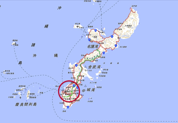
Do you know where in Okinawa Urasoe city is?
Urasoe city falls into the red circled area on the map above.
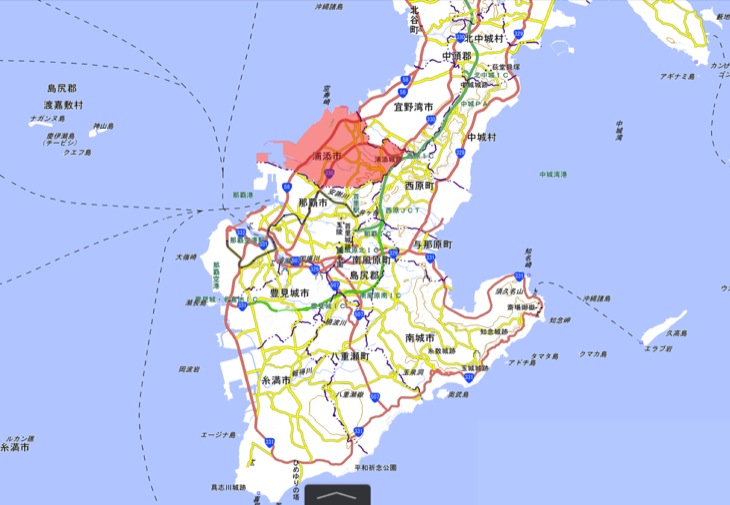
The city which has a population of approximately 110,000, is sitting in the north of Naha city, where the Naha airport is.
The red colored area on the map above is Urasoe city.
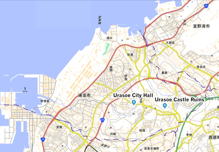
The city is a triangle shape, and there is a Urasoe City hall in the almost right middle of the city. There are two national roads (National Route 58 and 330) running from the north to the south of the city. The war site, ‘Maeda Escarpment’, is on the east side of the city hall. It is the same place as another Urasoe’s historical site, the Urasoe Castle Ruins.
First, let’s see how the American force marched on to Urasoe city during the battle of Okinawa in World War II.
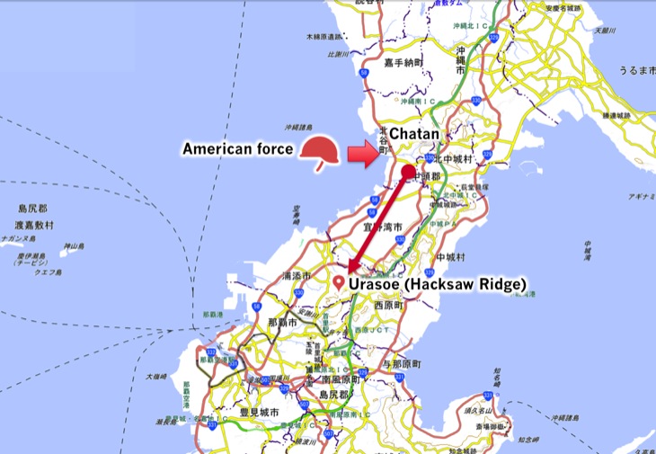
On April 1st of 1945, the American force began landing at a shore in Chatan.
A person who knows what happened then says that there was a tremendous number of battleships surging to the shore. In the film, it is depicted like...
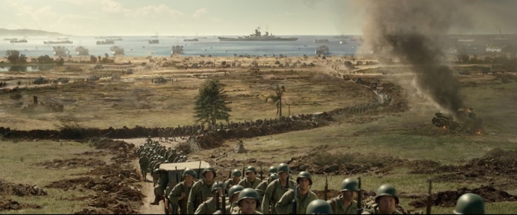
© Cosmos Filmed Entertainment Pty Ltd 2016
This. Let’s compare this with a picture taken back then.
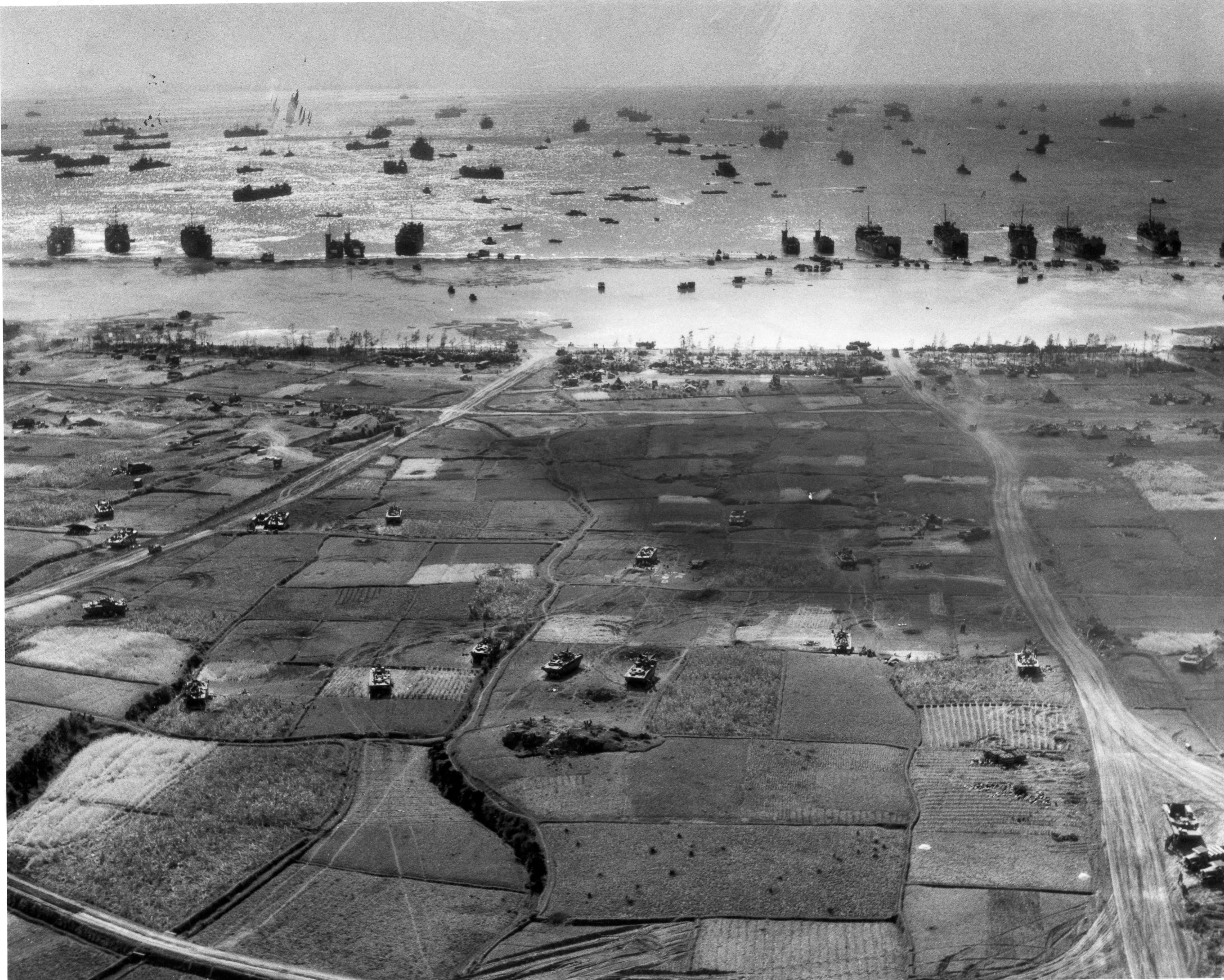
Source : Naval History Blog, U.S. Naval Institute
It shows how creators of the film conducted a close research and tried to recreate the scene precisely.
If you watch the film with this picture in your mind, every detail of scenes in the film will become as real as possible.
So, the American force landed at Chatan and begun attacking towards the south of the Okinawa Island. On their way to the southern area, a number of battles occurred. Right before they arrived to Urasoe from Chatan, brutal battles took place at Kakazu Escarpment in Ginowan.
Why the American and Japanese forces fought aggressively at Maeda and Kakazu Escarpment? It can be understood well by looking at a positional relationship of then important military footholds.
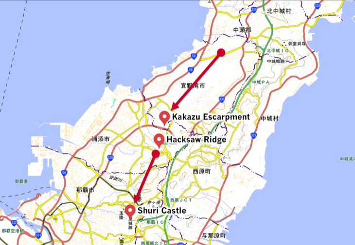
If you look at the map above, you can see a red straight line starting from Chatan, bypassing Kakazu Escarpment in Ginowan then reaches to Maeda Escarpment (Hacksaw Ridge) in Urasoe. At the very end point of the line towards the south, there is Shuri Castle where the headquarters of the Japanese force was stationed.
That is to say, Kakazu and Maeda Escarpment (Hacksaw Ridge) were on the route to Shuri Castle and the American force had to go through these two points in order to win the battle of Okinawa.
That is why Urasoe, which was located on the route to Shuri Castle, became the site of the brutal battle.
Maeda Escarpment (Hacksaw Ridge)
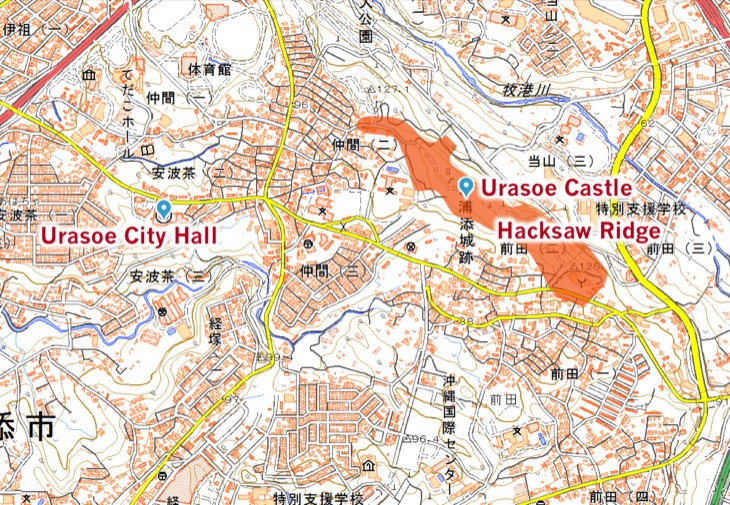
Maeda Escarpment (Hacksaw Ridge) refers to a hilled area of the Urasoe Castle Ruins. It was formerly a north side of former Maeda village, currently stretching from Yodore Hall to the Urasoe city fire station.
If you go from the north to the south in this area, you will see that there are hilly points here and there. The Japanese force, apparently, stationed garrisons on each of those hilly points.
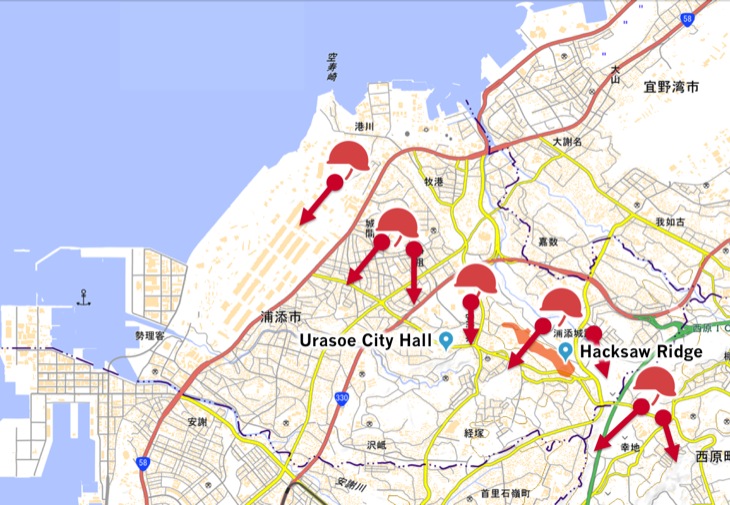
In Urasoe, a battle broke out at the end of April. The American force started arriving to a couple of sites in Uraose such as Makiminato, Gusukuma, Iso, Nakama, Maeda, and Nishihara.
However, because it was difficult for them to march with huge military tanks on steep hills or cliffs like Maeda Escarpment (Hacksaw Ridge), the corps had no choice but to carry attacks by their hands and legs.
The Japanese force, on the other hand, was brought into a vicious battle, having to attack the American force coming from the high point, or shooting and bombarding those who climbed over the cliff.
Maeda Escarpment (Hacksaw Ridge) captured by a Drone
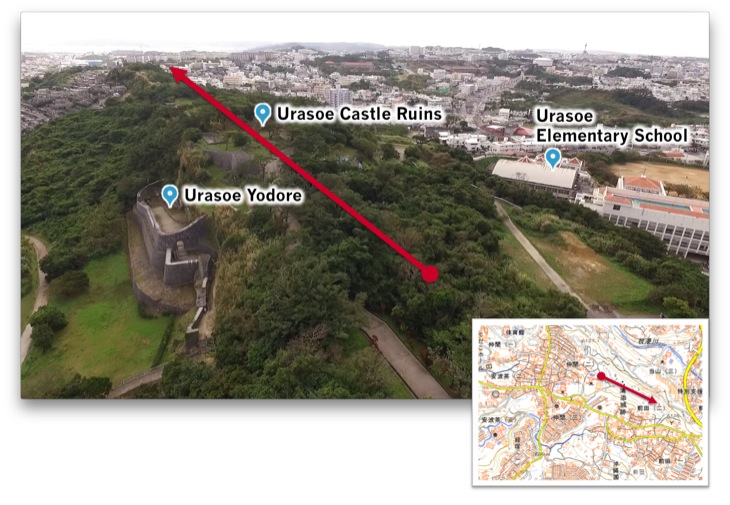
Let’s look at the site with some aerial photos captured with a drone. There is a map inserted above as a direction guide.
First, please go to the Urasoe Castle Ruins in order to go to Maeda Escarpment (Hacksaw Ridge). A castle wall that is currently under restoration will appear after coming from a parking lot nearby and going through a road surrounded by trees.
On the north side of the castle ruins, there is ‘Urasoe Yodore’, a tomb where two kings of the Ryukyu Kingdom, King Eiso and King Shonei are being entombed.
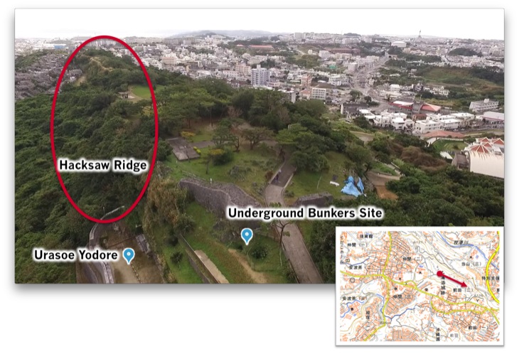
In front of the castle ruins, there is a cave that the Japanese force garrison used.
And a hill that is connected from the east side of Yodore is Maeda Escarpment (Hacksaw Ridge), the site of the film.

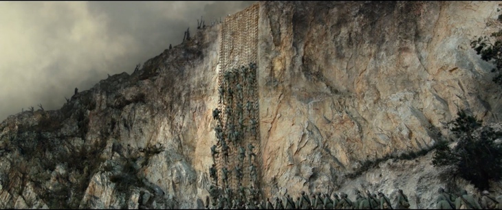
Although the site is now covered by tall thick trees that have grown for over 70 years and difficult to see its whole figure, a group of people standing on the top of the hill in the picture makes it visible how tall and steep the hill is.
The film perfectly reproduced the site as it was back then.
© Cosmos Filmed Entertainment Pty Ltd 2016
Many places in Okinawa are limestone that is upheaved coral reef. Maeda Escarpment (Hacksaw Ridge) is one of those made of limestone and it stood blocking the American corps as a huge rock. It is easier to feel its magnificence in person.

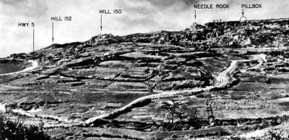
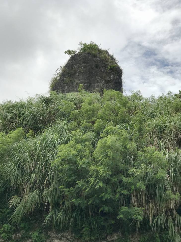
If you proceed the further east, ‘Needle Rock’ (called Wakariji or Hanariji in Okinawa) will appear. This rock is a symbol for residents in Maeda area and is designated as one of the ‘Urasoe Hakkei’ (Urasoe’s 8 best sceneries) which represents Urasoe city.
Source : U.S. Army Center of Military History
The Needle Rock shown in this picture above is Wakariji.

The area where the Needle Rock is located was too small so that a large corps could not spread out easily.
There are several caves on the left side of the hill shown in the picture above as well.
It is reported that the Japanese force practiced attacks towards the American force who were climbing over the hill.
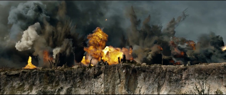
Side note* On the Internet, there has been a question raised as why the Japanese force did not carry the 'machine-gun attack' towards the American force from the cliff. There is a reason why. Because of a reconstruction project carried after the war, a lot of rock of Maeda Escarpment (Hacksaw Ridge) was shaved off for a purpose to use as construction material. The standing area was not as large as it is now back then, so that it was not enough for them to set machine-guns up.Therefore, the area of the hill top was only small enough for both the American and Japanese soldiers to stand close and grab each other.
© Cosmos Filmed Entertainment Pty Ltd 2016
On the north side of the hill, the American force did not have any risk of getting attacked from the Japanese force because they already occupied Kakazu Escarpment. But a brutal battle took place at Maeda Escarpment (Hacksaw Ridge) and many people lost their lives under the shower of artillery fire.
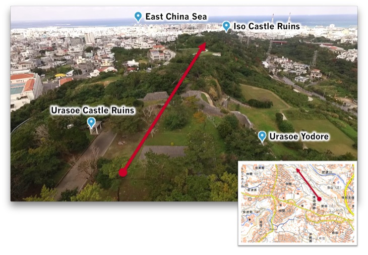
Facing opposite from Wakariji (the Needle Rock), now you see the north-west side of the city from Maeda Escarpment (Hacksaw Ridge).
There is Iso Castle Ruins where a battle which was as brutal as that of Maeda Escarpment took place. And there is a gentle slope hill continuing to the East China Sea. It is obvious from this landform, that the American force had no choice but to occupy Maeda Escarpment as a foothold in order to march down to Shuri, where the headquarters of the Japanese force was.
The brutal battle at Maeda Escarpment (Hacksaw Ridge) lasted for a couple of days. On May 6th 1945, the battle came to the end as the American force declared the occupation of Maeda Escarpment and the Japanese force decided to retreat.

Time has passed since, many people who watched the film started having an interest in visiting Maeda Escarpment (Hacksaw Ridge). There are a lot of visitors including foreigners accompanied by tour guides coming to the site.
The war, which took place at where the king who wished for peace of the Ryukyu Kingdom is being entombed.
Those who visit the site pray for the future where such horrible things will never happen.
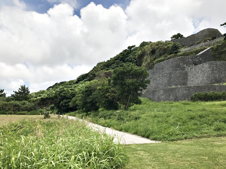
If you look up from Urasoe Yodore, you will see Maeda Escarpment (Hacksaw Ridge) up there.
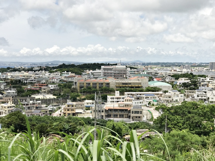
You will see Kakazu Escarpment on the north. This place was also a site of a hard fought battle.
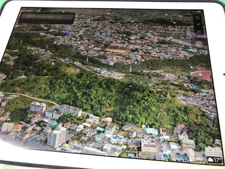
If you own an Apple product, you can check the area of Maeda Escarpment (Hacksaw Ridge) in 3D on the Map app.
When visiting Maeda Escarpment (or the Urasoe Castle Ruins), please refer to the maps shown on this page.
By using the ‘Map’ app available with Apple products such as iPhone, iPad, and iMac, a current view from Maeda Escarpment (Hacksaw Ridge) to Shuri Castle will be available in 3D.
The app will show you a bird’s-eye view of unique geographical features and height differences of the site where the brutal battle took place.
There are three parking lots around the site. Each parking lot continues to Maeda Escarpment (Hacksaw Ridge) by walk. If you plan to visit the site during the summer, please keep in mind that there can be strong sun and do not forget to hydrate yourself. Furthermore, please watch your step when visiting the site.
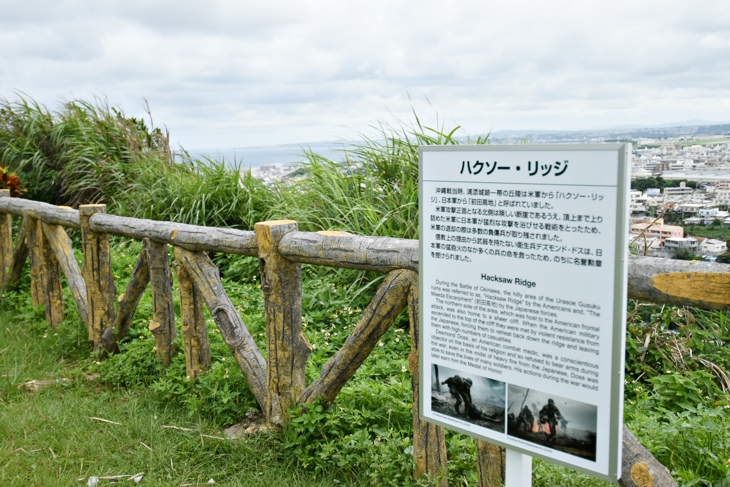
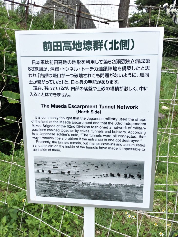
Sidenote* Guide boards which were requested by visitors are now available in both Japanese and English in this simple form. It is difficult to install built-in proper guide boards because this site is a nationally designated historical place and there is an archaeological research of cultural property going on. Should you have any questions or comment, please kindly inform us. We will try to respond as much as possible.
How to get to Wakariji (The Needle Rock)
I am going to explain how to get to Wakariji (the Needle Rock ) from the Desmond Doss point.
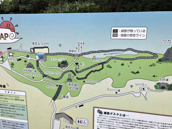
The Urasoe Castle Ruins is where the king used to be at prior to relocation of the capital to Shuri. There is currently excavation and reconstruction of the castle going on. Therefore, as the guide map above shows (a yellow triangle warning sign), there are some places where you cannot go through. You first need to go to where the Maeda Escarpment Peace Monument is by using stairs.
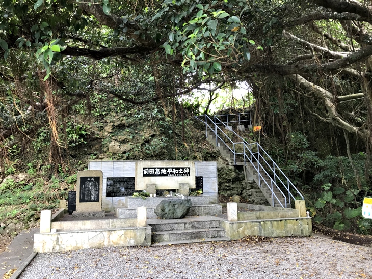
Please watch your step as the stairs are very narrow as shown in the picture.
This Maeda Escarpment Peace Monument was erected to honor the war dead from the 2nd Battalion of the 32nd regiment who lost their lives during the battle at Maeda Escarpment (Hacksaw Ridge). As of today, there is a grass field stretching in front of the monument. You can also see the view of the slope of Maeda Escarpment (Hacksaw Ridge). It is written on the guide map installed at the site.
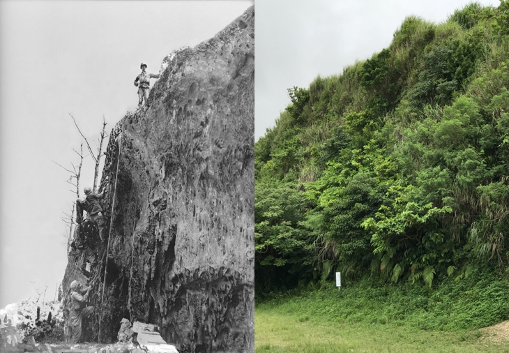
Source : Okinawa Prefectural Archives
A point falls right in front of Wakariji. A guy standing on the top probably climbed up the rock by hanging the lope at a point that is relatively easy to climb. The man standing on the rock in a monochrome on the left is said to be Desmond Doss.
You can see that there is a cave at the bottom of the rock in the picture. It is currently prohibited to enter due to a risk of collapse.
If you go further from the grass field, you will pass through a graveyard. If you go even further, you will see a path going down towards the entrance of the graveyard on the left side. On the right side, there is a road going up. The road on the right is what leads to Wakariji (the Needle Rock).
Side Note There is a guide ready at Yodore Hall so please ask questions about Urasoe Castle, the battle of Okinawa and other inquiries that you may have. The guide service is run by Uraosoe Historical Guide group (Yodore Hall opens from 9am to 5pm, is closed on Mondays (When Monday falls on national holidays, it is open). TEL:098-874-9345 Email: urasoerekisi@nirai.ne.jp )


